Globes, Maps, Flags (and Annie Lennox)
I have a thing for globes, maps and flags and, of course, for books, even while not proving a devotee of my Ipad. So, while browsing at William Stout Publishing a couple of Saturdays ago I found one of those books that is sorta legendary, not new, but new to me in its physical book-ness and objecthood. OIO Publishers published  that is such a pleasure to peruse. You engross yourself in the pink-red circles and the maps that go toward sepia but with enough yellow that their color strategy has nothing to do with Martha Stewart but makes terrain neither climate- nor place-specific yet globally modern. It’s the book design that also puts the context – along which vectors places connect – tactile: “core share, commuting time, crime,” among categories of comparison considered. The book opens with nifty tables dealing in metropolises of the year 0 (Rome in first place) and the year 1000, as well as 1950 and 2000. There’s fascinating seaport data, as well as the sorts of t hings that now qualify as conditions of preferred urban landscape, a subjective ideation that this book can help you sketch out through its design characteristics (Los Angeles, say, versus Berlin). In the Rocky Mountain West and our turf, included cities include Denver and Phoenix (but not Albuquerque), Dallas-Ft. Worth and Houston. The book costs $39 at Amazon.
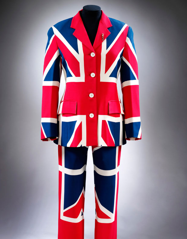
And then there’s Annie Lennox and the Union Jack. If you’re in London, the Victoria and Albert have given a one-room installation tothe House of Annie Lennox, which runs til 26 February and deals in sweet dreams and whiter shades of pale: the fashion iconography of what she wore; ephemera of political campaigns she championed; and so on. Now that just be a map of my times.
